Mementos, Notes, and Fragments
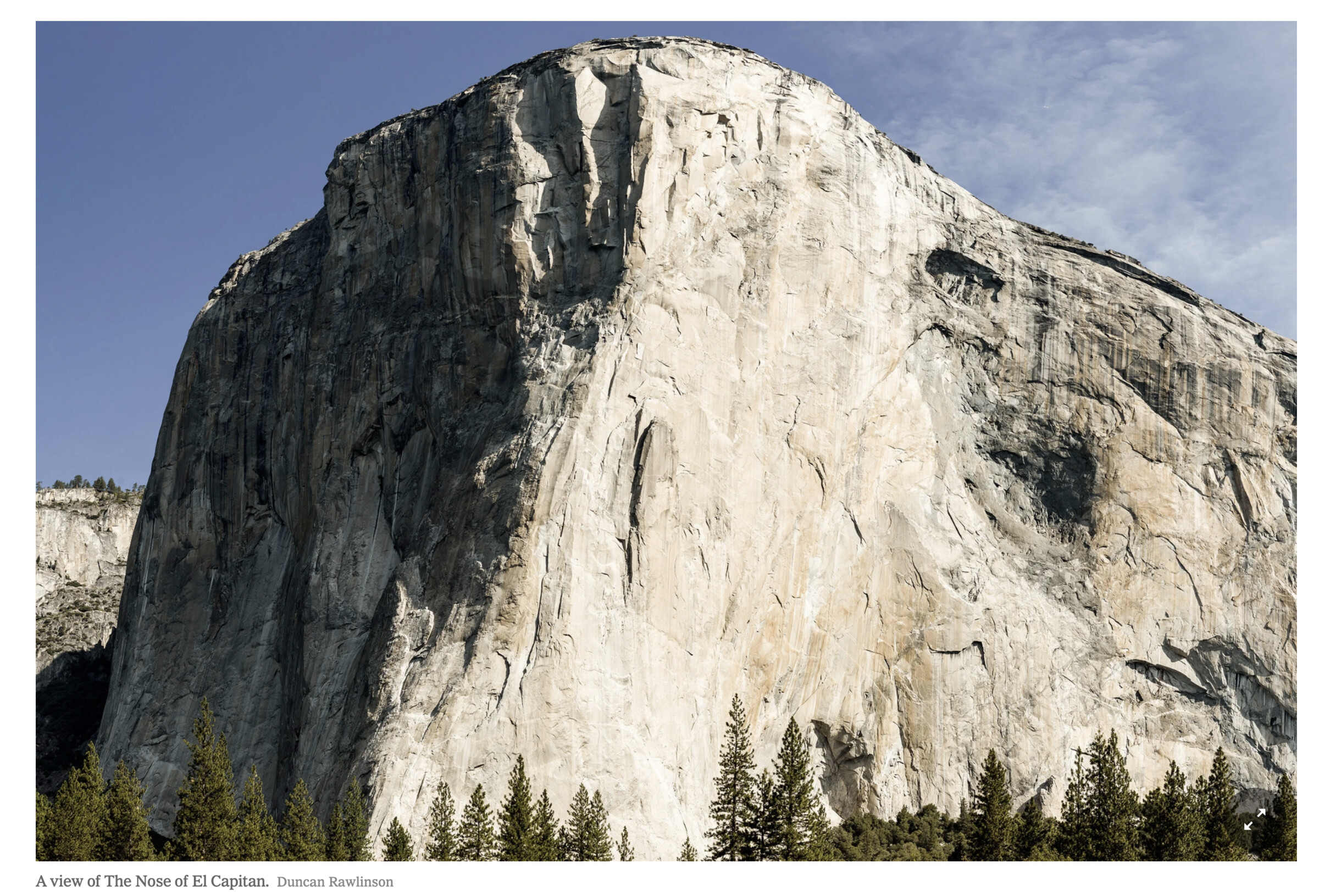
Famous El Cap Flakes Are Hanging By a Thread (So to Speak)
Gravity always gets its way, it’s just a question of when. For the iconic rock formation on New Hampshire’s Cannon Mountain known as the Old Man of the Mountain, that moment came in 2003, when the grizzled codger of granite gave up the ghost and collapsed. For Mexican Hat rock, the giant sandstone sombrero perched tenuously on an eroding tower in Southern Utah, the time is yet to come, and when you view it—or any other looming hunk of geology—you have to wonder, when’s that dang thing gonna fall?
It’s mere speculation in most situations, but on El Capitan in California’s Yosemite National Park, falling rocks have real and serious human consequences. In 2017, a climber was killed by rockfall on El Cap, and the park says that ten percent of fatal and near-fatal climber injuries are from falling rocks. (Park-wide in 2020, there were thirty-four rockfalls totaling nine thousand tons, both well below the annual average.) Of acute interest to climbers are the hundreds of flakes that dot El Cap like exfoliating skin, and two in particular: Boot Flake and Texas Flake.
Both are located on the Nose Route and are huge. Boot Flake (yep, shaped like one) is one-third the size of a tennis court and Texas Flake is twice that. In the late 2010s, geology researchers wondered if they could measure the “glue” that connects them to the wall: rock bridges that haven’t yet eroded.
Cleverly, they aimed a thermal imaging camera at El Cap and recorded temperatures. Air circulating behind the flakes registered cooler than the rest of the wall—except where rock was still attached to the Nose.
Armed with data, the team, led by a doctoral candidate at Switzerland’s University of Lausanne, calculated the rock bridge connecting Boot Flake is fifty-five square feet, or about seven percent of the flake itself. As for Texas Flake, just sixteen square feet, or less than one percent, attach it to El Cap. A rock feature below the flake helps support it, but still: If you’re about to chimney up, it’s more than mere speculation to wonder.
The Middle of Nowhere Has an Address But It Adds Up to Nothing
Atlantis, shmatlantis, Null Island is a real imaginary island. It’s located in the Gulf of Guinea off the west coast of Africa. It has its own flag (several, actually). For a while, it had its own website and Twitter account. And as for its spot on earth, in the words of British cartographer Kenneth Field, “Null Island has for many years been a single, somewhat isolated state of indeterminate sovereignty located at 0,0 (zero latitude, zero longitude).”
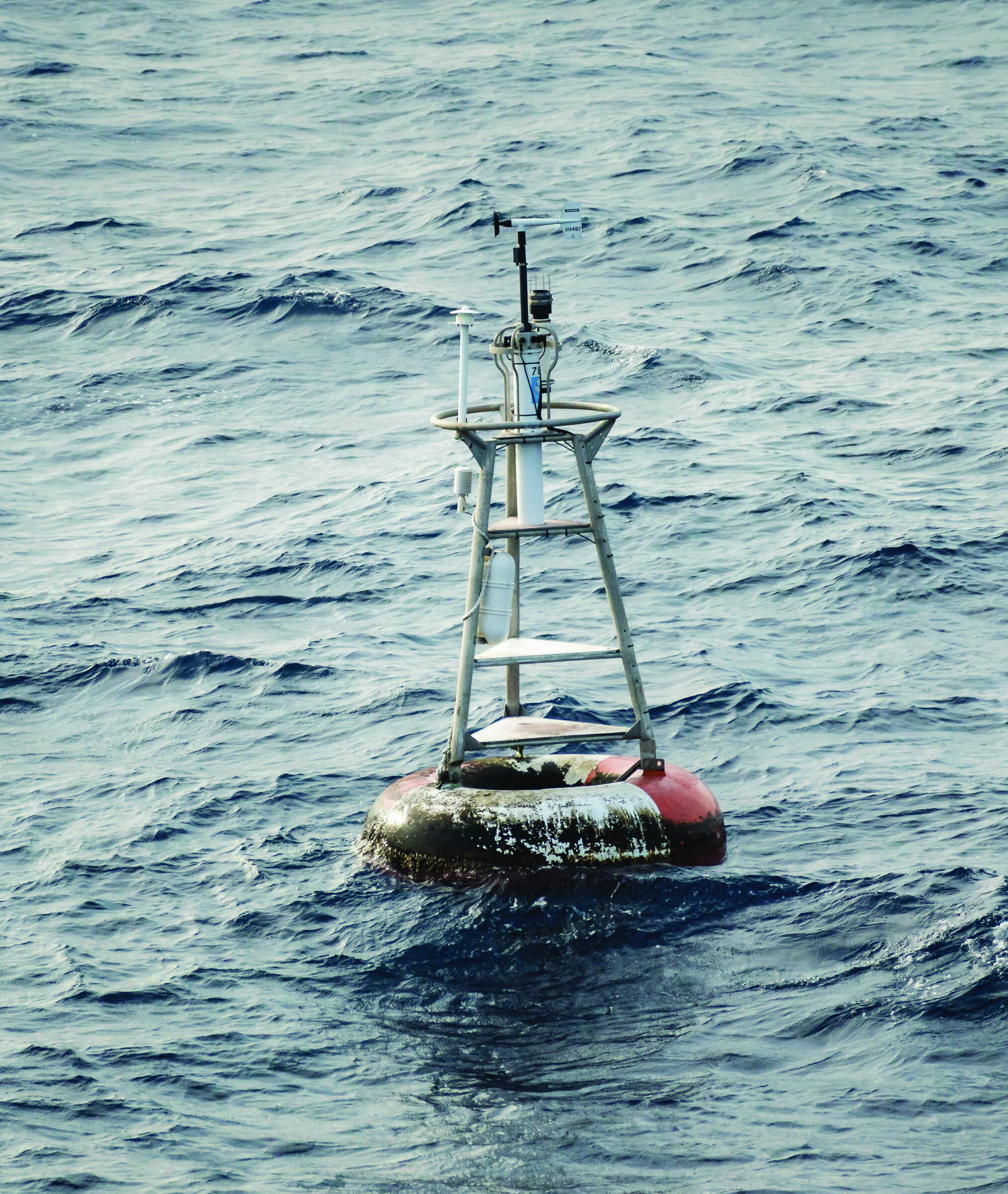
Map enthusiasts will be quick to recognize those coordinates as the crossing of the prime meridian and equator. But Null Island isn’t just a spot of indeterminate sovereignty, it’s also a place of indeterminate land. More precisely, there is none; all you’ll find at 0,0 is water, water everywhere and a weather buoy known as Station 13010 Soul.
Mariners have long told tales of lost or disappearing islands, but Null first appeared in 2011. It stems from a quirk in digital cartography. Geolocation systems—nearly anything handling an address—frequently encounter errors or missing location data (untagged phone photos, for example), so they assign “0,0” in place of the real lat/long. Other software reading that data is coded to ignore it, and it usually does, but sometimes it takes 0,0 literally and a random Cinnabon or Chipotle winds up mapped in the middle of the ocean. A decade ago, while creating the Natural Earth public domain mapset data, Nathaniel Vaughn Kelso and Tom Patterson jokingly labeled this spot Null Island and gave it a one-square-meter landmass.
Since then, Null has taken on a life of its own, with said flags, website, social channel, and maps. Delightfully, Kenneth Field points out that every coordinate system (there are many more than lat/long and the commonly used WGS84 datum) has its own error-location protocol. In fact, using these protocols, he’s mapped almost six thousand Null lakes, mountains, deserts, and, yes, islands. There’s even, he says, a Null black hole event horizon, “where no one can hear your coordinates scream.”
Nothing Throws Shade Like a Cardón Cactus
Baja California must have seemed as alien as another planet when French chemical engineer-cum-naturalist Léon Diguet arrived at his Santa Rosalia mine posting in the late 1880s, and in his off time he dove into the desert with the unbridled enthusiasm of an explorer turned loose in a strange, new environment. Diguet studied the cochineal insect from which carmine red dye is derived, archaeological burials and rock art, the Huichol language, and the properties of agave and jojoba. Altogether, he made seven trips to Mexico and brought home a massive collection for the Muséum National d’Histoire Naturelle in Paris.
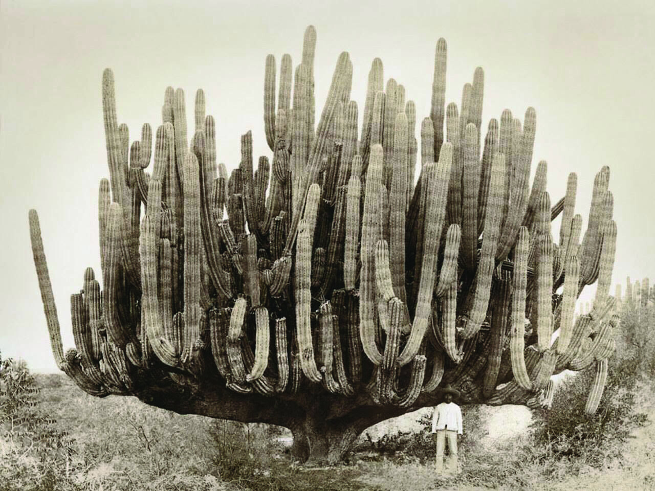
Diguet is little known outside France and would likely be completely unknown—sorry, guy, but it’s true—were it not for a volume of his writing published posthumously in 1928. Les Cactácees Utiles du Mexique, or The Useful Cactuses of Mexico, is five hundred and fifty-four pages of riveting observations (kidding) that happen to include a gobsmacking photo of a cardón cactus accompanied by an adult man for scale. Diguet was fond of shooting cactuses and putting people next to them, but none can touch this 1895 pic for making you think wait, what?
The crazy thing is, cardóns get a lot bigger. Diguet’s is estimated to weigh ten tons and stretch to a little over thirty feet high, but cardón can grow taller than sixty feet and weigh twenty-five tons. Indeed, the first photo in Les Cactácees reveals the Manute Bol of cacti: Its fifty-nine feet of height dwarfs the burro rider next to it.
Cardón live in Baja and Sonora and are related to the saguaros of Arizona, though their branches start lower on their trunks and they have fewer ribs. The Seri people of Sonora called the cactus xaasj, and they are said to have harvested portions for psychoactive properties. Just spitballing, but here’s guessing that long, trippy afternoons in the shade of a cardón were popular with the Seri, and maybe even, considering those seven visits, with Diguet.
Knitting George Mallory’s Sweater
When the doomed British Everest expedition of 1924 left England, George Mallory was carrying wool socks knit by his wife, Ruth, as well as a handmade Shetland wool sweater purchased from Alan Paine in Godalming, southwest of London. The knitwear designer was a top supplier to the British military, and he hired local women to craft his pieces. During World War I, they murmured their prayers, hopes, and blessings into each stitch, almost as incantation, and thus sanctified the garments. Whoever knitted Mallory’s sweater would have done the same.
In February 2016, operating room nurse and knitting enthusiast Stacy Abernathy and Everest climber Andy Politz led a group of high schoolers across a hundred miles of Yellowstone National Park’s caldera—Politz as guide and Abernathy as chaperone. Conversation turned to Andy’s 1999 expedition on Everest, when he and his team found Mallory’s body near twenty-seven thousand feet. Mallory was wearing the sweater, Politz said, and he could see it like it was yesterday. Abernathy mused aloud, Hey, how about if I make this for you?
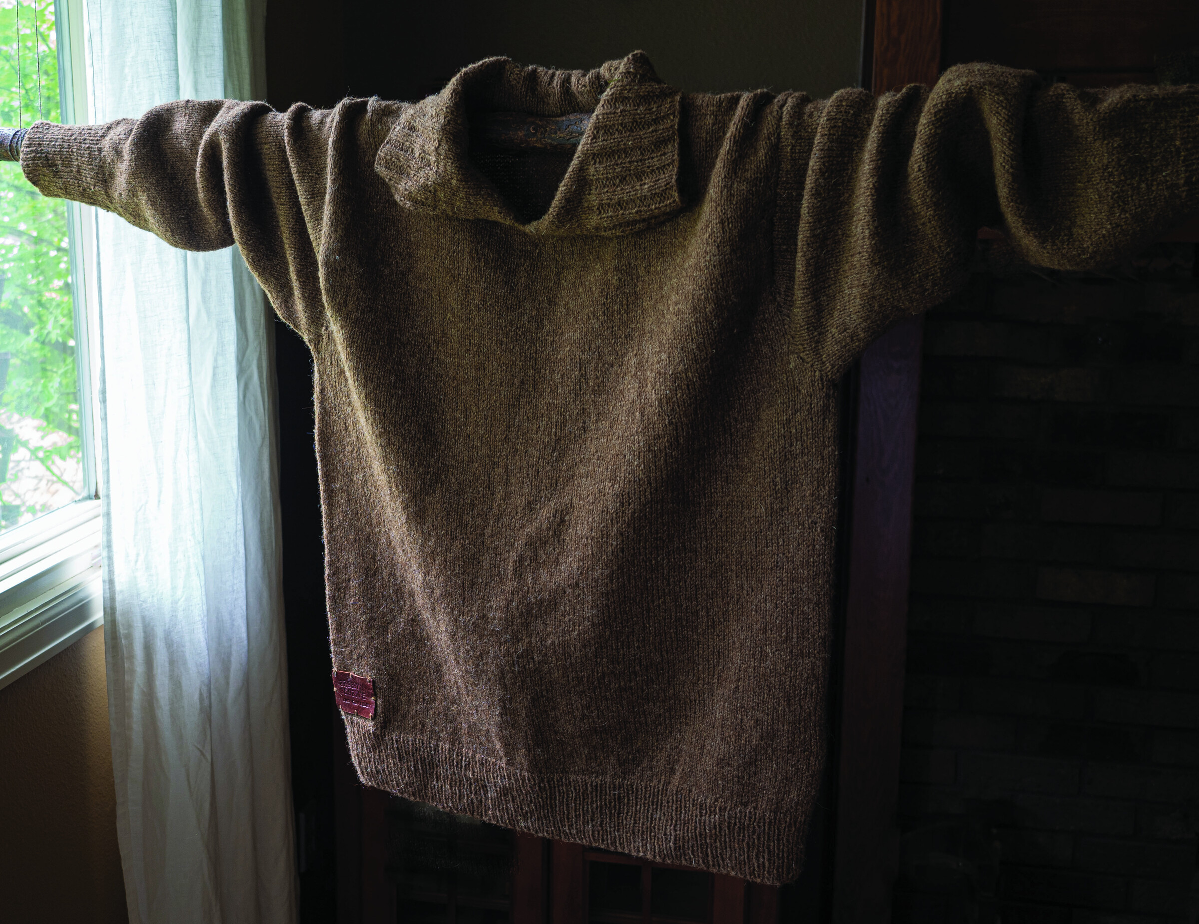
The process took four years. Joyce Meader, an expert on historical knitting who recreated Mallory’s clothing for the Mountain Heritage Trust, sent a page from a 1910 knitting book outlining the needle size and gauge, which is the number of stitches per inch and row. Yarn came from Jamieson and Smith, the top U.K. supplier, and Abernathy matched the color with Moorit wool, named after a breed of sheep. She completed some of the ribbing, but life happened and she tucked the project away.
In spring 2021, she opened her copy of Adventure Journal 21 and found our story about the discovery of Mallory’s body. Within an hour, randomly, Politz texted her from Kathmandu on another Everest expedition. She took this as a sign to push on, and within two months Mallory’s sweater was complete.
What had begun as a lark evolved into something poignant. Britain was terribly scarred by the first World War, and that experience directly informed the men who attempted Everest and the women who cared for them. As she worked, Abernathy imagined Ruth, knitting those socks, investing all her love into the promise of a safe return. The replica sweater was never intended to be a present for Politz, it was more of a historical curiosity, and in the end, thinking of all those British knitters, Abernathy was likely the one most touched by it.
42 issues. 11 years. Independently owned. Printed on 70lb uncoated paper with a soft-touch cover, solar-powered, and shipped in a brown paper envelope. Free domestic shipping.