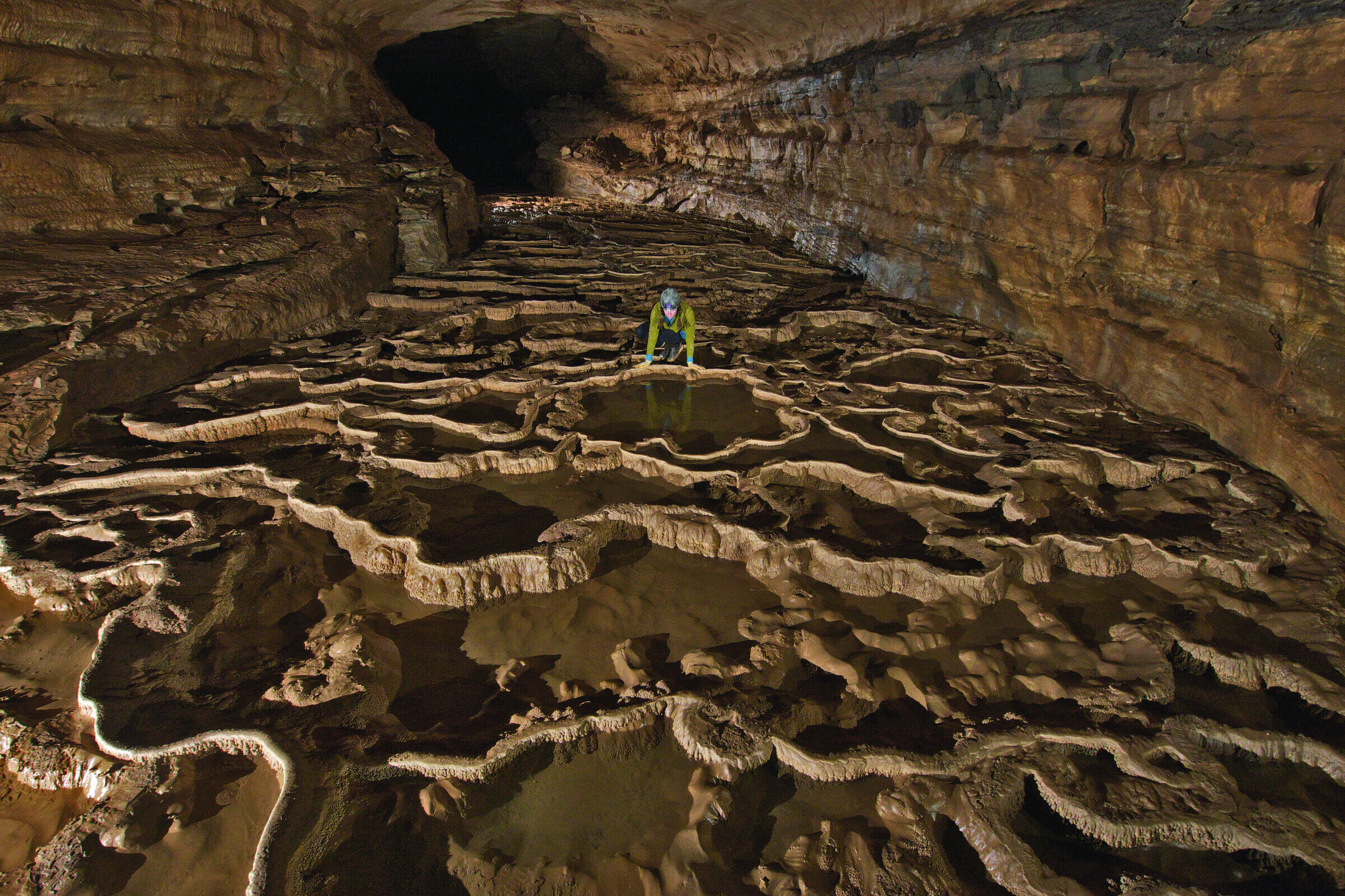
In the Doll's Head section of Fisher Ridge Cave System, Johanna Kovarik leans down to look at a reflection in the still waters of a rim- stone pool.
Mapping an Underground Labyrinth
Spelunker-cartographers have spent decades in Kentucky surveying one of the world’s longest caves
Hike through a certain cow pasture in Kentucky and across a field of waist-high grass and you’ll hit the edge of the forest. Just a few minutes more and—if you know where to look—you’ll find a sinkhole and, at the bottom of that, a metal hatch. This hatch leads to the Fisher Ridge Cave System, one of the longest caves in the world.
The nearby Mammoth Cave National Park is home to the world’s longest cave system, with more than four hundred miles of underground passages. Mammoth has been a tourist attraction since the late 1800s. Fisher Ridge, by contrast, was discovered only in 1981 by a team of cavers who call themselves the Detroit Urban Grotto. They have been exploring and mapping it ever since, so far charting more than one hundred twenty-eight miles of underground passageways.
The cave is known for its abundance of sparkling white gypsum crystals, which sometimes form delicate white “flowers,” says the Grotto’s chairman, Stephen
600 words to go
You’re just getting to the good part.
This story — and 42 issues of them — opens with a subscription.
Either one picks up right where you left off.
Join 7,000+ readers · Independently owned · Since 2008
Already a subscriber? Sign in
Adventure Journal — Print Quarterly
Stories like this, in your hands four times a year.
42 issues. 11 years. Independently owned. Printed on 70lb uncoated paper with a soft-touch cover, solar-powered, and shipped in a brown paper envelope. Free domestic shipping.